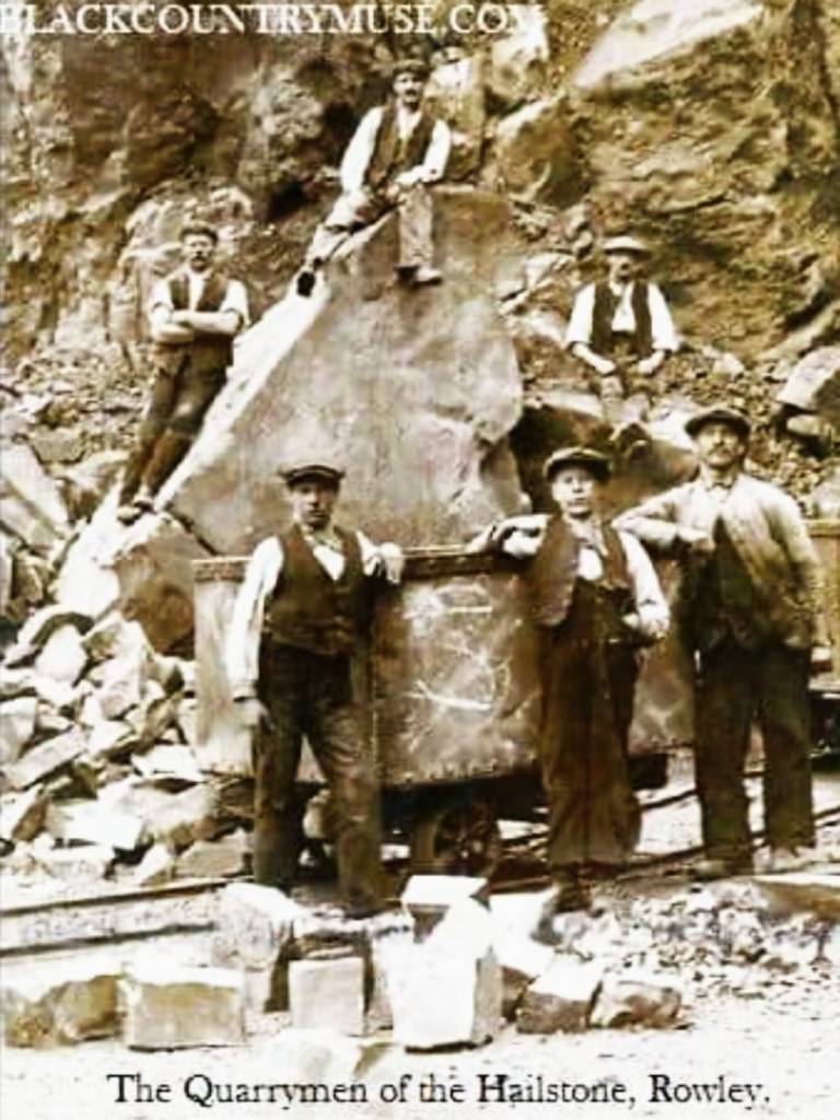
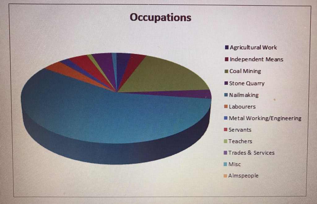
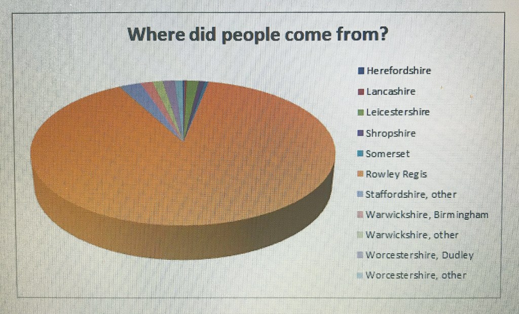
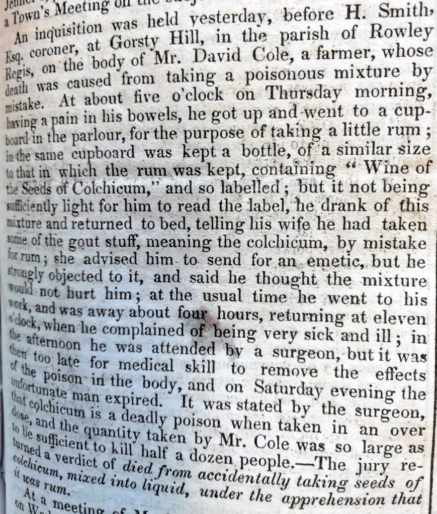
Another place which appears from time to time in all of these quarrying communities as place of birth is Bedworth, near Nuneaton. I had noted some time ago from my own family history research that Nuneaton and Bedworth seemed to have various links with Rowley Regis. So, who shall I choose to look at with Nuneaton connections?
‘The Squire’
John Beet (1775-1844) who lived at Rowley Hall in the early 1800s and was known in Rowley as ‘The Squire’ was born near Nuneaton in 1775. I have a head start here as he was my second cousin 6xremoved, so I have already done quite a bit of research on him.
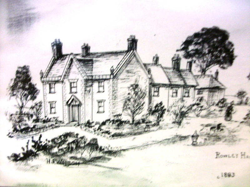
Rowley Hall 1893, Copyright unknown, drawing thought to be by H R Wilson, if details of Copyright are known please let me know.
In his will, proved in 1844, John Beet left legacies to his cousins and family in Nuneaton in the event that his only daughter Elizabeth died childless (which she subsequently did. Her Clergyman husband contested the Will to try to prevent a substantial legacy going to the grandchildren of John Beet’s cousin but was unsuccessful, John had made very specific and unmistakeable provision for £3,000 to go back to his Nuneaton family although Rowley Hall and the mineral rights passed to the son of the clergyman by his first wife; he never lived there). John Beet’s Will makes it clear that he already had a substantial income from coal mining by 1844 and he disposed of his coal mining rights very carefully.
John Beet and his family have an impressive tomb still surviving in St Giles’s churchyard.
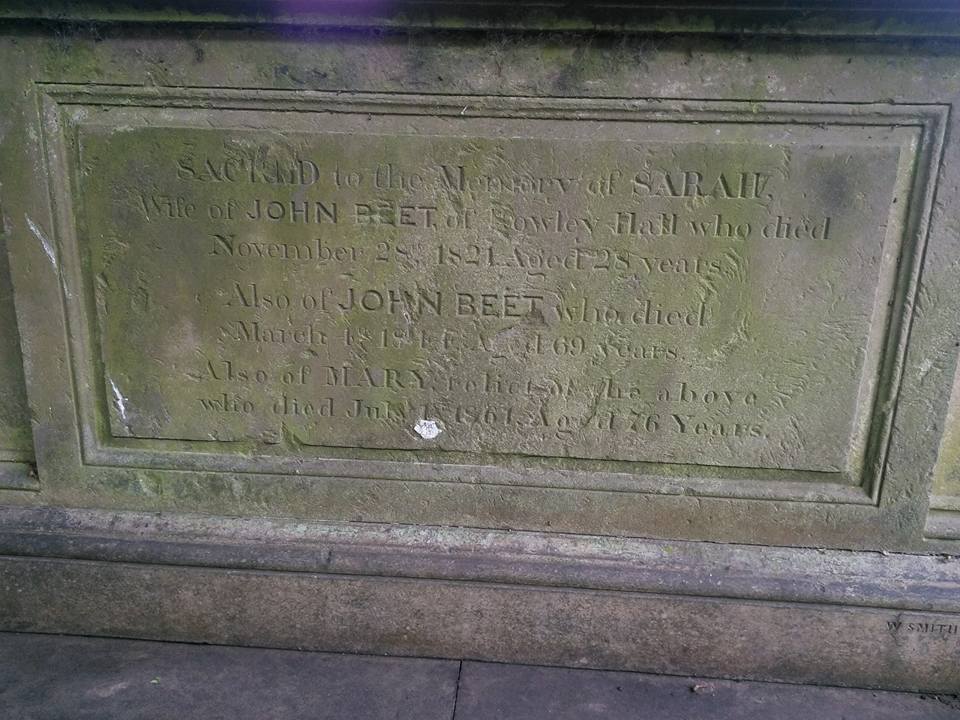
The memorial on one side of the Beet Tomb. John’s sister Elizabeth and her husband are also buried in this tomb and also his daughter Elizabeth, although apparently not her husband.
There have been a couple of mysteries for me about John Beet. First, how did he come to settle in Rowley Regis? His parents Thomas Beet and Sarah Dunn were married in Feb 1744 in St Philips in Birmingham. John was from and presumably raised in Witherley in Leicestershire.
I say presumably because John and his sister Elizabeth were the only two children of their parents, both baptised in Witherley but orphaned when John was six and his sister five. I have the Wills of both John’s father and grandfather who both died in 1761 and both left what appeared to be substantial property to the two children. Thomas Beet Senior, John’s grandfather, describes himself as a Yeoman in his Will and left John “my house and land situate and being in the parish of Halesowen in the County of Worcester now in the tenure of Cottrell together with all outhouses, edifices, buildings, Barns, stables, Yards, gardens, orchards, Backsides Homesteads, trees profits and appurtenances whatsoever thereunto belonging or in any wise appertaining. My will is that my grandson John Beet aforesaid take possession and enter upon the aforesaid estate when he arrives at the age of seventeen.”
It sounds as though it was a very substantial farm. So there was a first indication of connections not far from Rowley. Plus he left John another house in Bond End in Hinckley, Leicestershire.
John’s father Thomas, who died a few months before his father, described himself as a Husbandman in his Will, (which is defined as a farmer dealing with animals), and had also left him his own farm in Witherley, again to take possession when he was seventeen – which would have been in 1792. His sister was also left substantial bequests, including a house and all of Thomas Senior’s domestic goods which again would come to her when she was seventeen, in 1793. In the meantime trusteeship and guardianship of John and his sister appears to have been vested in Richard Beet of Nuneaton, who was a cousin and Benjamin Kirkby who I think was John’s brother-in-law.
So where was Sarah Beet, John’s wife and mother to the children? There was no mention of her in either Will so it seemed likely that she was dead. Or perhaps she had run away, never to be spoken of again? She was certainly not buried in the Witherley area at that time, where both Thomases were. And she had been married in Birmingham but that could cover many surrounding places. There was no formal registration of Births and Deaths before 1837 so you are looking for burials, or possibly a Will. But a will would be unusual for a young married woman.
So, whilst writing this article, I decided to try one resource which I was not familiar with when I last looked for Sarah’s burial. I searched FreeREG. (This is slightly ironic as some of my readers will be aware that I have been transcribing Rowley Regis and Blackheath church registers for the last couple of years for FreeREG.) So I entered the dates of daughter Elizabeth’s baptism (5 Dec 1776) and Sarah’s husband’s burial (23 Apr 1781) – such a short period, only five years. I searched the whole country. There were only two entries found. One was in Sheffield, not very likely, I thought, no known connections with that area. Then I looked at the second entry. St Giles Church, Rowley Regis. Sarah was buried in Rowley Regis….. and I was then able to find a baptism of a Sarah Dunn, also in Rowley Regis. (Not transcribed by me, I’m pleased to say, I surely wouldn’t have failed to make that connection had I transcribed the record!! ) There was a loud clunk in my brain as various things dropped into place – that was John Beet’s connection with Rowley, it was his mother’s home. I have a new line to explore!
I wonder whether John and his sister may have been less than popular with their Nuneaton cousins, with whom they were probably brought up. The family seems to have practised primogeniture, the eldest son got all or most of the land and property which might account for other branches of the family being poorer. Thomas Beet the elder, having made very generous provision for John and his sister, left twenty shillings each – £1 – to each of his other grandchildren in the Nuneaton area, a very nominal sum.
Elizabeth Beet had apparently moved to Rowley with her brother John and she married William Sprigg a Gentleman of Dudley, at St Giles on 11 Apr 1799, when she was 23 so presumably brother and sister were already established in Rowley by then. When the Enclosure Act went forward in 1807-1808, John Beet, of the Hall Farm, was relieved of manorial dues under that Act and, giving his occupation as ‘butcher’ he purchased land at Whiteheath, adjoining his existing property. He married a local girl Sarah Higgs in 1818, before starting mining and quarrying on his property sometime later.
But John’s Beet family in Nuneaton and Weddington were graziers, people who raised and traded in cattle, an occupation which often includes farming or the butchery trade or both. As graziers and drovers they would travel round the countryside, buying up cattle, taking them back to their own farms and then fattening them ready for slaughtering and butchering. This may have been why Thomas Beet Senior owned a farm in Halesowen, to raise cattle there. The Beets may not have been the only graziers in Nuneaton, there was a Graziers Arms there, now demolished but sited on the Weddington Road, next to the railway station where probably they moved stock by rail once the railways had been built. Presumably as graziers they had their known routes and regular suppliers. Nuneaton would have been well placed, near to centres of population in Leicester, Coventry and Birmingham. Another branch of his family later settled in Coventry where they were butchers and poulterers, all in the butchery trade. Nuneaton had easy access to farming country and excellent transport links, situated just off Watling Street.

This 1841 map, copyright unknown, appears to be based on the Tithe Map and shows that although Nuneaton had a long main street and appeared prosperous and busy, it is surrounded by pasture, perfect for raising cattle.
There was another Beet living in Rowley, in Tippity Green, my 4xg-grandfather Thomas who was also born in Nuneaton in 1764 so was a few years older than John Beet. He also moved to Rowley Regis, probably twice. I was not sure, at first, whether there was any connection between Thomas and John Beet because certainly their stations in life were very different, wealthy squire and labourer/pauper. In 1841, 1851 and 1861 Thomas was living in Tippity Green, probably in the Poorhouse there.
There is a Removal Order from the Poor Law authorities in Nuneaton in 1820 relating to Thomas who was widowed and his two young sons who were deemed to have no Right of Settlement in Nuneaton, that is they were not entitled to go into the workhouse there or to parish relief and they were removed, sent to Rowley Regis. (Many thanks to my fourth cousin Margaret Thompson for sharing this with me, Thomas’s son Joseph was our mutual ancestor). The reason for this settlement decision is unclear as Thomas was born and married in Nuneaton and his sons were born there. One reason might be that he had previously lived and worked in Rowley which meant that the Poor Law Authorities in Nuneaton could repudiate him when he fell on hard times. He died in the Poorhouse in Tippity Green in 1852, aged 88 and was noted in the Census as being blind. But it seemed such a coincidence that both came from Nuneaton. It took a lot of digging amongst records and sideways clues but in the end I was able to confirm that Thomas and John Beet were second cousins.
They must, in a village the size of Rowley, have known each other, even if John Beet, for all his wealth, made no specific provision for his cousin in his Will. I have wondered whether Thomas worked for John Beet at an earlier date which might account for him losing his settlement rights in Nuneaton. Thomas’s son Joseph was living in Spring Row which was the row of tied cottages behind Rowley Hall in 1851 and 1861, working as a labourer, so perhaps Joseph also worked for the Beet family, John Beet’s widow continued to live at the Hall after her husband’s death, until her own death in 1861. But John Beet’s line died with his daughter, whereas his cousin Thomas’s persisted for much longer. Beet Street in Blackheath may have been developed by John’s widow, who gave her occupation as ‘owner of houses’ and certainly some of Thomas’s descendants lived in Beet Street for some years.
However, in his Will, John Beet made the following bequest:
“I give and bequeath unto the clergyman of Rowley Church and the occupier of Rowley Hall for the time being the sum of three hundred pounds. And it is my wish and I direct them to nominate and appoint under their hands in writing six proper persons to be trustees jointly with them for the purposes hereinafter mentioned, that is to say: Upon trust to invest the said sum of three hundred pounds upon freehold or governmental security and to crave the interest and proceeds thereof and give and divide the same unto and between such poor persons residing in the parish of Rowley as they or the major part of them shall consider fit and proper objects for relief, part in clothes and part in money. I hereby direct that the clergyman and occupier of Rowley Hall for the time being shall in case any or other of the said trustees to be appointed by them shall die or refuse or become incapable or unwilling to act are to appoint other trustees or trustee in the place of the trustee or trustees so dying or refusing or becoming incapable or unwilling to act so that with the clergyman and occupier of Rowley Hall there shall always be eight trustees.” Perhaps John Beet had his cousin in mind when he made that provision. I have not found any reference to this Trust anywhere else so have no idea whether it was implemented, amalgamated with another Trust or, at some point, wound up.
I was also interested to note that one of Thomas’s sons Daniel was recorded as a ‘Horse Doctor’ and as a horse dealer in Quinton and then West Bromwich in later years, carrying on the family association with the trading of animals.
Other Bedworth connections
But in looking at these migrations for work, I have discovered more things in common for Bedworth/Nuneaton and Rowley Regis – Bedworth was the site of large stone quarry, with dolerite amongst the rocks found there – more quarrymen! Industries in Tudor Nuneaton included leather tanning and brick making. From the mid-16th century, there was also an ironworking industry. Furthermore, although coal mining began in the Nuneaton area as early as the 14th century it boomed in the 17th and 18th centuries. And there were coal mines in Bedworth, too. Did Thomas come to Rowley to work in the quarry or a mine? Did he move with John and Elizabeth or was he here first? Was he blinded here in an accident or was it simply a medical condition such as cataracts? I shall never know.
In the 1851 Census, 78 people living in or within 5 miles of Rowley Regis gave their place of birth as Bedworth and 101 as Nuneaton. Many of these lived in the Dudley, Tipton and Tividale area. John Darby, 49, Engineer lived at the Brades and gave his place of birth as Oldbury so he was not far from home. But his wife Jane was born in Blaenavon, South Wales and also in his household was a May Darby, a widow of 73, perhaps John’s mother, who was born in Bedworth. What do these three places have in common? Ironworks!
Job Millichip, aged 51 was living in St James’s Terrace, Dudley, he was an iron stone miner, born in Bedworth but his wife and all of his children were born in Dudley.
Two women Susan Darby and Mary Haygill who were in Dudley Road described their husbands as Boatmen, presumably away from home on the night of the census and both women gave their place of birth as Bedworth. Canals would also have been an easy link between the Nuneaton/Bedworth and the Rowley area. Certainly in the 1861 Census, Joseph Eaton, in Hurst Lane Tipton, gave his occupation as a boatman and his place of birth as Manchester. But his wife Harriet was from Worcester and their son Joseph, aged 2 was born in Bedworth. Those with boatmen ancestors, including my husband, know well that when families lived on the boats, children could be born anywhere on the canal and river systems!
I was interested to see that two men Thomas Arnold, 24 and Henry Beasley, 37, listed in Tipton in the 1851 census gave their place of birth as Nuneaton and both were hairdressers, not a common occupation locally. Henry’s son George, aged 15 was also listed as a hairdresser, also born in Nuneaton.
There were other Beasleys who came from Nuneaton in the 1861 Census. Another Henry Beasley, aged 29 was living in Lye Cross, close to the Rowley and Oakham quarries, and he was a Stone Cutter. His wife Elizabeth, was a ‘riband weaver’ and their three children under six were all born in Nuneaton, so they had probably moved here recently. Their boarder John Lilley, 47, also a stone cutter was also from Nuneaton. A visitor Mary Lilley, perhaps John’s relative, was from Wolvey near Nuneaton and was also a ‘riband weaver’. Coventry, only a few miles from Nuneaton, was well known for ribbon weaving – another skill on the move!
In the 1861 Census, 60 people living within 5 miles of Rowley gave their place of birth as Bedworth and 113 more as Nuneaton. Most were coal miners or stone cutters, this time many of them were in West Bromwich. In Tipton, John Butler, aged 60, was a ‘Pork Dealer’, another instance of the meat trade originating in Bedworth.
By contrast, only a handful of people living in Bedworth and Nuneaton in 1861 gave their place of birth as Rowley Regis. Familiar Rowley names – Enoch Hipkiss, 22 a nailer; Jesse Parker, aged 15, born in Rowley but son of a coal miner born in Bedworth; Benjamin Baker, 49 and his son David aged 14, Captain and Boat Boy respectively of a canal boat called ‘Industry’, more evidence for the existence of a canal link; Josiah Whittal, aged 50, a whitesmith. In Nuneaton, John Smith, 16 year old was the Rowley born son of a Colliery Clerk born in Sedgley.
So a familiar pattern emerges, though not as pronounced as with Mountsorrel, of workers moving from Bedworth and Nuneaton to the Black Country for work, marrying locally and then often moving on or moving back. Two members of the ‘I remember Blackheath and Rowley Regis’ Facebook page have already told me that members of their family moved to or came from Bedworth/Nuneaton.
As I transcribe more censuses I may revisit this topic if any more of interest emerges.
The Clergy Connection
And there is one more link between Rowley and Nuneaton. The Reverend George Barrs, the notable Curate of Rowley Regis from 1800-1840, was also born in Caldecote in 1771, four years before John Beet. Caldecote is 2 miles north of Nuneaton and less than three miles from where John Beet’s family lived.
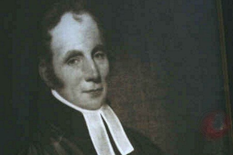
Copyright unknown.
A coincidence? Perhaps! Might they have been at school together? There may be school records somewhere, I shall investigate. There is a family tree online for George Barrs, I shall also look at that to see whether I can find any links to the Beet family. Might the Squire have had some influence in the appointment of the curate and chosen someone he knew of from home? It does not seem unreasonable.
One more post to come on people moving for work – to Threlkeld in Cumberland, definitely connected to stone quarrying. But I have more research to do on that so it will not be for a while. Again, members of the ‘I remember Blackheath and Rowley Regis’ Facebook page have already mentioned this in comments, any further information would be very welcome.