This may seem obvious but to those of us who grew up there in the mid 20th Century, seeing across the landscape almost always through an industrial haze, it was easy to forget that the hills and heaths had once been rural and agricultural landscapes and that my mother could remember, as late as the 1920s, walking over fields from Oldbury Road in Blackheath to Bell End in Rowley, seeing haystacks, picking wild flowers, paddling in the stream and watching the farmers at work.
My childhood walk to primary school at Rowley Hall was across the ‘Bonk’, one of the many huge spoil heaps from mines and quarries and in later years, unofficially, even less child friendly substances from chemical works. It was stony, gritty, pink or grey in places, green and shrubby in others with steep slopes for sliding down on tin trays, unfathomed pools and, my brother and his friend swore, a tunnel which they had explored and which led down to Whiteheath. He was right, it turned out, though I never found it, it would have been part of the tramway from Rowley Hall quarry and mine to Titford Basin. A similar tramway ran from the Hailstone quarry under the road at the Knowle down to the Dudley Canal, using gravity to move the heavy coal and stone to the waterways which would transport it further afield. The bonk was not somewhere many parents nowadays would allow their children to play unsupervised, but to us, the many children who used it as a giant playground, it was simply a natural part of our surroundings. It was only when I was an adult that it dawned on me that we had been playing on a waste heap!
But there were several farms and farmers in or near the lost hamlets on the 1841 census and some of these were still there in the 1940s; perhaps someone will tell me one or two are still there.
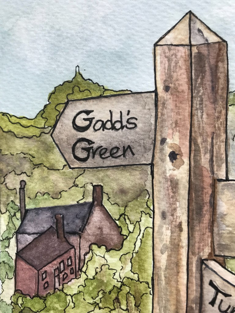
They were, like other places, called by different names at different times. Sometimes Freebodies Farm, Hailstone Farm, Brick House Farm, Gadds Green Farm, Turner’s Hill Farm, Windmill Farm, Portway Hall Farm – different records used different names, perhaps depending on the source of the information. At other times they would have been known by the names of whoever was farming there. Even in the 1950s and 60s, once you had left Springfield on the way to Dudley, there were green spaces either side of the road, though there may once have been quarries and mines there. Not smooth green meadows but greenish.
Reg Parsons, who was born and grew up on Turner’s Hill told me that his mother and father, who had a shop in Doulton Road, were walking on Turmer’s Hill one day and his mother saw some wild sweet peas growing in the hedge. What a lovely place this would be to live, she said. So when a piece of land with three condemned cottages became available there, they bought it, Reg’s father demolished the cottages and built a new house, No 2, Turner’s Hill and they moved to it. That was later sold to a local businessman who wanted to live looking over the golf course before that, too was demolished. What a view some of these houses must have had and how lovely to think that wild sweet peas grew in the hedges.
Reg recounts that his father worked in Dudley and, when he needed items from the shop at Springfield, he would get off the bus there, get his shopping and then cut across to walk up over the fields and home. Reg also recounted that, when he was at Britannia Road School (a fair walk in itself) he would call in at a farm off Hawes Lane to milk two of their cows. On the way home he would call in and milk the cows again, having his evening meal with the farmer and then walking home. As Reg said, he was working longer days than when he started his first real job. But his family – and other families in the area were mostly self-sufficient, keeping chickens and a pig, growing vegetables and getting milk from the local farm.
The map from which the extract below is taken, the First Edition of the Ordnance Survey, shows the Turner’s Hill area. This One Inch to the Statute Mile map was derived from two topographical surveys, the first completed between 1814 and 1817 by members of the Royal Military Surveyors and Draftsmen and probably assisted by local surveyors hired for the task. Numerous revisions for the rapidly changing Black Country were completed by 1831-1832, shortly before the first printing in 1834. Copies of the original surveys are preserved in the British Museum. Sheet 62, from which this small extract is taken, was engraved on four separate sheets of copper by the engravers’ workshop at the Tower of London where the first copies were also printed. The names of surveyors, engravers and printers are all recorded. This fascinating information is printed on the David and Charles Reprint edition, along with a great deal more detailed information. My recently acquired copy cost me the grand sum of less than £10, including postage so if, like me, you love old maps, it is worth seeking one out.
Information on the maps tells us that “The engravers’ workshop at the Tower was under the direction of Benjamin Baker. He employed six or seven assistants, each of whom was responsible for a particular aspect of the map – hills, water, woods, lettering and so on.” The Rowley Hills would have provided plenty of work for the one responsible for hachuring the hills!
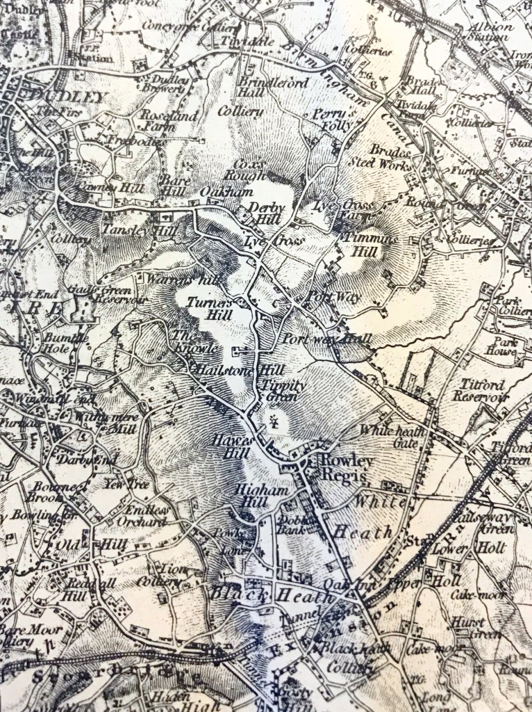
Copyright David & Charles, Newton Abbot, Devon.
The map shows that most of the area of the Rowley Hills was still undeveloped then, although clusters of houses and some quarries are shown, the steel works at the Brades is shown and the railways are already marked.
The map shown below is an extract from the very useful Alan Godfrey Reprint of the 1904 OS 6″ to the mile, sixty years or so after the 1st Edition where you can see much more detail of the quarries around the hamlets. The hatching shows that many of the houses backed on to sheer drops into the quarries and many would end up being consumed by the quarrying operations. The Prospect Quarry was the site of a windmill at one time and there was still a Windmill Farm in Tippity Green appearing in records long after the mill had gone.

Copyright: Alan Godfrey Maps
So while we may have gone to Quinton in my childhood to see the bluebells or to Clent to ‘the real countryside’, there were some green spaces of sorts all around us and around our ancestors, despite the prevalence of quarrys, factories and pits. Interestingly, the old quarries are apparently now being filled in and greened over so perhaps the hills will become a green and pleasant land again after all these years. Though one suspects that the push for new housing may take priority…