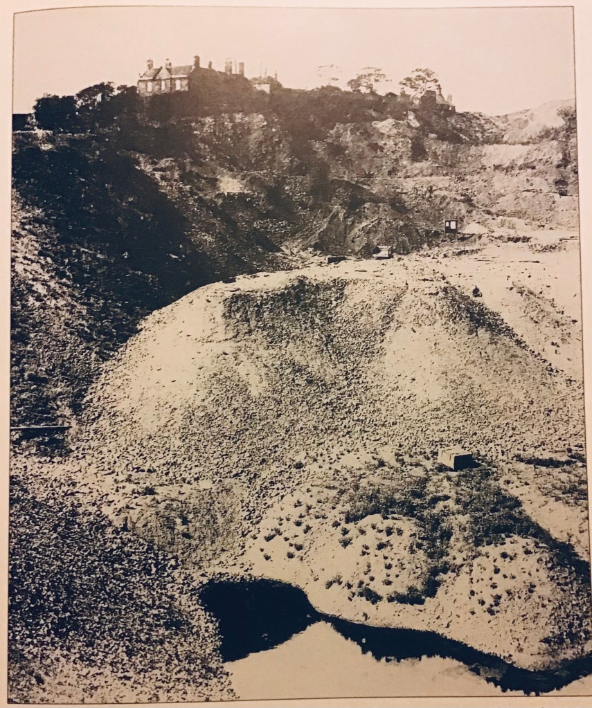
While researching my 6xg-grandfather Edward Cole, some years ago, I had found what appeared to be his baptism in Rowley in 1680, the son of John and Joane Coal/Cole/Coles. Spellings were flexible in those days as most people were illiterate and spellings varied with the priest or clerk who was making the record. Most people stayed within or near to their own communities and I think it is entirely possible that these Coles lived in or near Fingeryhole, marrying within the community, as they did for many future generations.
So I was very surprised a few years ago when Ancestry (where I keep my family tree) offered me a hint that Edward had been married in London in what is known as a Fleet Marriage. Ancestry hints can be useful but always need to be treated with caution and the original sources they refer to always have to be checked before I consider adding any information to my tree.
Feeling rather doubtful , I looked at the Fleet record for this marriage. But there was Edward Cole, a Nailer, marrying Diana Land in 1730. And in the Parish Records for Rowley Regis, over the next 27 years Edward and Diana Cole were baptising eleven children in Rowley Regis, so it does appear that this was the right marriage.
All sorts of queries arise. Why was a humble nailer from the tiny village of Rowley Regis in London? How did they meet? Edward was already fifty in 1730, so a very late marriage. Where was Diana from? Both of them were recorded at the time of the marriage as being from the Parish of Christchurch, Surrey . Why were they married in a Fleet Marriage? Most of these questions remain unanswered nearly twenty years after I first found out about this!
Fleet marriages or Fleet Registers: From the Middle Ages onwards, the ancient Fleet Prison was a prison for debtors and bankrupts and for persons charged with contempt of the Courts of Chancery, Exchequer and Common Pleas; it was also a place of confinement for persons committed from the Court of Star Chamber. It stood on the east bank of the Fleet River in London. More than 200,000 clandestine or irregular marriages were performed in London between 1667 and 1754. The area around the Fleet Prison was particularly notorious, hence the name ‘Fleet Registers’. In the 1740s, over half of all London weddings were held at the Fleet (over 6500 per year) with a further thousand conducted at the May Fair Chapel.
By the late 17th century, provided that a couple exchanged vows and had some proof of this, then a marriage would be considered valid. Marriages by a form of ceremony conducted by an ordained clergyman, but without banns or licence, and generally not in a church or chapel, usually away from the parish of the bride or groom were termed clandestine marriages. The main appeal of clandestine marriages was seemingly for reasons of cost. Other reasons for their popularity included the avoidance of the need to obtain parental consent, and also to conceal embarrassing pregnancies.
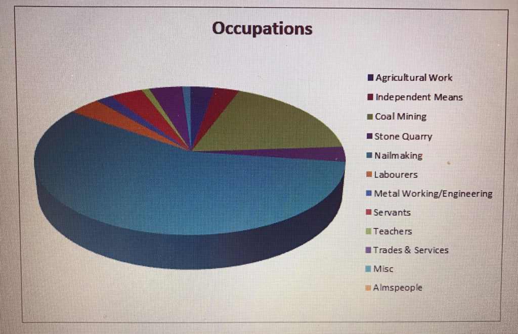
The marriages performed at the Fleet involved all classes from London and the surrounding counties, but mainly catered for artisans, farmers, labourers and craftsmen from the poorer parishes of London, soldiers (including Chelsea Pensioners), and particularly sailors so this popularity with artisans would tally with Edward’s occupation as a nailer.

This drawing, copyright unknown, shows a Fleet marriage, not taking place within the Fleet prison but in the vicinity. The notebooks of the clergy taking the marriages are in the National Archives.
I can find no trace of Diana/Diannah Land anywhere before she marries Edward Cole, although there were Lands in Norfolk who had individuals over a period of years with the name Diana so that is a possible home area for her. Presumably she would have been about twenty or less when she married, as she had children for another 27 years. If I have the correct Edward Cole, he was 50 at the time of the marriage so 77 when their last child was born – possible but unlikely, I suspect. He is the only Edward Cole baptised in Rowley Regis at that time.
Another possibility is that the Edward Cole who married at the Fleet was not the Edward Cole originally on my tree who was born in 1680. Going from his date of marriage to Diana (1730) and the dates of birth of his last child (1757), I would have expected his date of birth to be about 1705 but there is no Edward Cole born in Rowley in that period. Perhaps he was baptised nearby but if so, I have not yet found him. There are numerous other Cole births, the family was here and, from the fact that Edward and Diana settled in Rowley and all their children after them, makes me think that there is a strong likelihood that Edward came from Rowley or at least had strong family links here. So at present Edward and Diana are my earliest known ancestors in Rowley and many but not all of the Coles in and around the Lost Hamlets are descended from them. However, Edward’s burial in 1766 seems to be the only mention of an Edward around that period.
I also puzzled about what a nailer from tiny Rowley Regis was doing living (presumably) in London, at least for long enough to meet and woo a bride. No doubt there were people then who got itchy feet and wanted to see the streets paved with gold, just like Dick Whittington, so perhaps Edward just wanted an adventure. Or – here it comes again – perhaps he travelled for work.
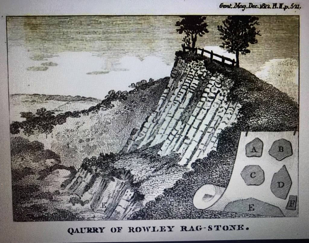
There was a family called Crowley in Rowley Regis in those times. They were nailmakers and iron mongers. The first Ambrose Crowley had a child baptised in Rowley in 1639 and the name appears in the Registers until well into the next century. One of the Crowleys moved to Stourbridge where he was a nailer and ironmonger and his son Ambrose moved to London where he became a hugely successful merchant , supplying nails and ironmongery to the Government and especially the navy. The navy used a lot of ironmongery! In the National Archives there is a lot of correspondence from this Ambrose Crowley, concerning the orders and deliveries.
I may do a separate article about Ambrose Crowley, later Sir Ambrose because he did have Rowley connections and he was obviously a very interesting man. However, I can’t definitely associate him with the lost hamlets!
He issued detailed instructions on how the nails he was buying should be packed (this document is still in the British Library)and it is clear that some of his supplies came from the Black Country, possibly through his father. Sir Ambrose listed all the kinds of nails made for him, with the marks placed on the bags before they were shipped to London. That the nails were transported in bags is plain from the detailed instructions he gave to his managers for ‘the bagging of Nails and Baggen’. He wrote:
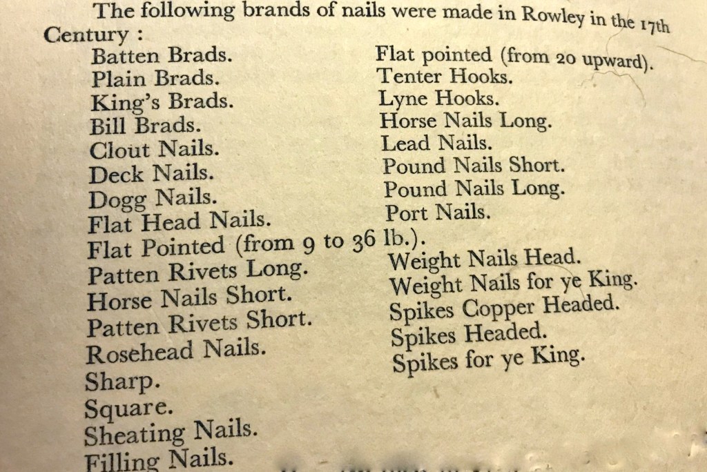
“The unsizeableness of Baggen I have found to occasion Short and dumpling baggs or else extreme long so that it is impossible to regularly Pile them when at London. For remedy I do order my Baggen to be only of 2 breadths, namely 22 inches for weight na : Dock na : and Tile Pinns and for other sorts that will admit of a greater breadth to be 25 inches wide”. He then specified exactly how the bags should be cut and sewn to minimise waste of fabric and at the same time to ensure against any loss by leakage during transport. J Wilson Jones in his book says that in Rowley therefore, as soon as any one workman had made enough nails to fill a bag, his stock was weighed and his number put on a tally amd sewn up inside the bag, which was to be ‘well shaken’ before the end was ‘sewed up well not with too wide stitches’. To the outside of each bag the nailkeeper was to attach a tally of ‘seasoned white wood and holes burnt in for a fastening’. The words Crowley’s Best Tough’ were to be written on every tally with the mark appropriate to the nails inside as ‘Cowley’s Best Tough L7’ – Lead nails. So substandard nails could be traced back to the individual nailer, 17th century quality control! He certainly paid attention to detail, a very shrewd businessman.
He also set up a huge factory up on the Tyne. There are numerous letters in the National Archives collections from him to the Government, requesting safe conducts for his named couriers and people making deliveries especially to naval dockyards, even for his lighterman who remained in London criss-crossing the Thames. The reason that he needed safe conducts was that this was the period when able bodied men anywhere near the coast were at risk of being press-ganged into the navy. Since Crowley’s business involved sending men frequently into precisely these areas to make deliveries, this would be a real hazard for them. He got his safe conducts!
When Sir Ambrose died in 1713, aged 54, he left over £100,000. He had premises in London at Greenwich and in Thames Street. His family continued the business and the naval contracts so it is more than likely that supplies from the Black Country continued to be sent to London.
This made me think about how the nails themselves would have been transported from their place of manufacture. From his factories on the Tyne Crowley apparently used ships. Were young men from Rowley recruited to escort the nails and other ironmongery by land to Crowley in London? Presumably, in the quantities he was selling them, they would have had to be transported by cart so they would be vulnerable to theft, so perhaps an escort was necessary. Perhaps Edward Cole took the chance to travel to the big city with nail deliveries and stayed a while or even visited regularly and got to know Diannah Land there.
Another possibility is that the Edward Cole born in 1680 worked for the Crowleys as a courier/nailkeeper, married and had children in London and that it was one of these children that married Diana Land. There was a marriage in Jan 1704 between an Edward Cole and a Mary Downer at Southwark St George the Martyr who may, just possibly may, have been the parents of the Edward Cole, son of Edward and Mary Cole who was baptised in 1705, at St Martin in the Fields. This would fit with this scenario but there is no information in the register about their origins or abode and records are sparse at this early period. So I may have a missing generation on my tree.
Edward Cole was buried in Rowley in 1766 and Diannah in 1770. They have many many descendants around Rowley.
All speculation on these connections but fun!