This is not strictly within the Lost Hamlets but concerns a member of the Cole family who was born there – and it’s a fascinating story so I am sharing it with you anyway!
Even after 40 years of research, I still find new facts on my family. Recently I was working on siblings of my 4XG-Grandfather Edward Cole and tracking their descendants, a task infinitely easier than it was when I first worked on Edward himself 40 years ago. With the advent of digitised records and family history programs and online resources, plus, of course, the many subscription services research has utterly transformed.
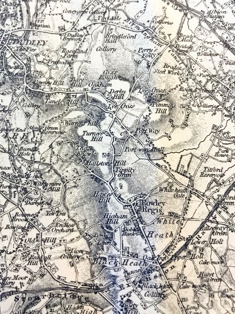
Searching through the Cole entries in the St Giles Registers, I came across the Burial Record on 14 March 1832 for my 1st cousin 5xremoved David Cole. The entry says that he was 43 when he died in Mar 1832 and that he was a farmer living in Slack Hillock , off Gorsty Hill. I was picking out Cole burials, spotted the note on his made by the Vicar and was off down a fascinating rabbit hole, irresistible!
A note in the Register , added by the Vicar, says “Poisoned by drinking a composition which his wife retailed as a specific for the gout”. How about that for a damning story in a few words? I had to know more. I did some sleuthing and found a newspaper report in the Wolverhampton Chronicle dated 14 March 1832.
David Cole had woken at about five o’clock in the morning, with a pain in his bowels and had gone to get a nip of rum to settle his stomach. The ‘specific’ made by his wife, was called ‘seeds of Colchicum’ and was stored in the same cupboard as the rum in a similar bottle. The bottle containing the mixture was labelled “Wine of the Seeds of Colchicum” but it was not sufficiently light for him to read it. When he returned to bed he told his wife he had taken some of the gout mixture and she was concerned and wanted to get a physician to purge him but he strongly objected to this, saying that he did not think the mixture would hurt him. He went off to work as usual but returned four hours later at 11.00am, feeling ill and very sick and took to his bed. He died two days later. The surgeon who had attended him later on the afternoon he was taken ill could do nothing and told the inquest that he had taken ‘enough of the mixture to kill half a dozen people’. The jury returned a verdict that he “died from accidentally taking seeds of colchicum, mixed into liquid, under the apprehension that it was rum.”
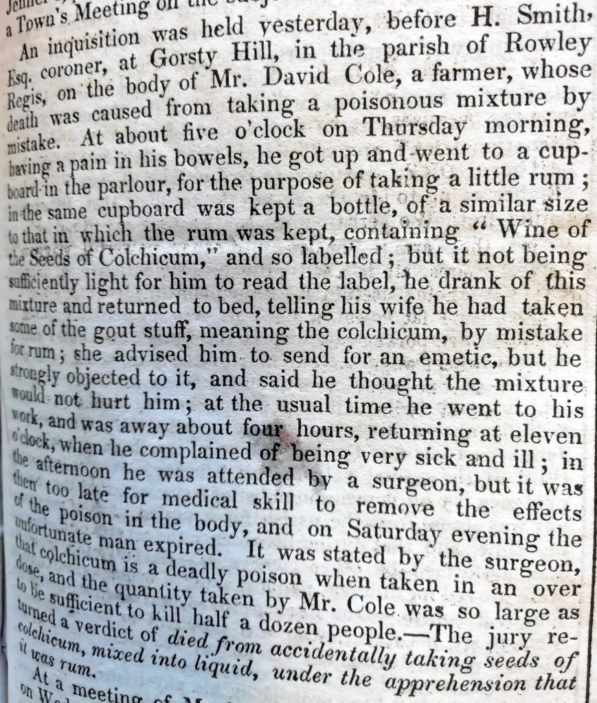
Copyright Wolverhampton Chronicle.
He left his wife Charlotte with thirteen children, the youngest David baptised in June 1832, after his father’s death so it seems very likely that Charlotte was heavily pregnant when her husband died. However, the oldest were old enough to be already working, one as a butcher and others on the farm and she stayed there, listing herself as a farmer for many years after that. I wonder whether she carried on selling her remedies?
But doesn’t this little story actually tell us quite a lot about them? Yes, she was a farmer’s wife but also a herbalist of some knowledge and known as such to local people. I wonder who taught her? Perhaps a family skill? When I looked into it, seeds of Colchicum is still listed by present day herbalists as a treatment for gout but with warnings that it is toxic in large quantities and may cause death. And, to my geat surprise, when I recounted this tale to a genealogist friend who has recently had extensive heart surgery, she responded immediately that “Colchicum is still recommended by the NHS! When I saw my consultant a couple of weeks ago, he recommended colchicine for gout”. So an extract of Colchicum is still used by the NHS today. Charlotte Cole actually knew her stuff, it seems.
Copyright: Glenys Sykes
And there were few remedies for painful gout in those days, if I remember correctly. Presumably she was known to local people for her remedies, hence the Vicar’s somewhat judgmental comment that she sold the remedy. But they didn’t have pharmacies as we know them then, no picking up a remedy at the chemist or pharmacy as we might and probably most people couldn’t afford to consult doctors.
How devastating for Charlotte to have witnessed this tragedy, her husband killed by her own remedy and to have suffered the reproaches of someone like the Vicar and possibly others for something that was not her fault.


